 |
 |
 |
| |
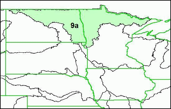
Souris-Red-Rainy (Hydrologic Region 09)
|
The Souris-Red-Rainy drainage area is composed of hydrologic region 09.
The Souris-Red-Rainy hydrologic region is further identified by production unit: 09a.
NHDPlus Shapefile and DBF components are distributed by hydrologic region.
NHDPlus ESRI Grid components are distributed by production units.
For more information please see Souris Red Rainy Release Notes in
DOC,
PDF.
Download instructions:
Right click on a file name in the table below and choose "save file to disk."
(or)
Go to ftp.ftp.horizon-systems.com.
Right click on a file and choose "save file to disk."
(or)
You may connect to the NHDPlus FTP site (ftp.ftp.horizon-systems.com)
with an FTP client. FTP clients are generally faster than file transfer through a browser.
|
|
Filename Key
| NHDPlusrrVnn_componentname.zip |
| where: |
| rr is the hydrologic region number |
| nn is the currently available version of the data |
| componentname describes the content of the zip file |
|
| File Description |
File Name (.zip***) |
Format |
| Region 09 , Version 01_01, Catchment Grid |
NHDPlus09V01_01_Catgrid |
ESRI Grid* |
| Region 09, Version 01_01, Catchment Shapefile |
NHDPlus09V01_01_Catshape |
Shapefile** |
| Region 09, Version 01_02, Catchment Flowline Attributes |
NHDPlus09V01_02_Cat_Flowline_Attr |
DBF**** |
| Region 09, Version 01_02, Elevation Unit a |
NHDPlus09V01_02_Elev_Unit_a |
ESRI Grid |
| Region 09, Version 01_01, Flow Accumulation and Flow Direction Unit a |
NHDPlus09V01_01_FAC_FDR_Unit_a |
ESRI Grid |
| Region 09, Version 01_01, National Hydrography Dataset |
NHDPlus09V01_02_NHD |
Shapefile and DBF |
| Region 09, Version 01_01, QAQC & Sinks Spreadsheet |
NHDPlus09V01_01_QAQC_Sinks |
Excel Spreadsheet |
| Region 09, Version 01_01, Stream Gage Event |
NHDPlus09V01_01_StreamGageEvent |
DBF |
|
|
*An ESRI Grid is a proprietary format for a raster dataset that
defines space as an array of equally sized cells
arranged in rows and columns. Each cell contains
an attribute value and location coordinates. Unlike a
vector structure, which stores coordinates explicitly,
raster coordinates are contained in the ordering of the
matrix. Groups of cells that share the same value
represent the same type of geographic feature.
**A Shapefile
is a published, but proprietary, data format from
the Environmental Systems Research Institute, Inc. (ESRI).
***Zip
is a common type of file compression.
****DBF
|
|
